
Flat Earth Maps
Throughout the history of the Flat Earth Theory, multiple models and maps have been proposed. This page aims to showcase the most prominent examples, and to serve as a reference for those seeking visual guides.
Layout of the Continents
Generally speaking, the main point of contention among Flat Earthers is the several theories concerning the nature and extent of Antarctica, as well as the overall layout of the continents.
Many believe that Antarctica is the Ice Wall encountered by Sir James Clark Ross, whereas some believe that Antarctica is simply a 'rim continent' surrounding the known Earth and that the term Ice Wall is misleading. Others believe that Antarctica is an isolated and distinct continent and that though an Ice Wall exists, it is not Antarctica. The latter model generally assumes that the geography of the Earth is quite different to that outlined in the conventional model.
Below are images of the two Flat Earth geographic models, which convey the different concepts of Antarctica within Flat Earth Theory:
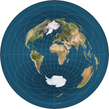
Monopole Models
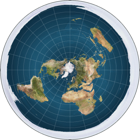
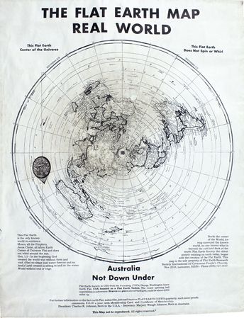
The standard monopole Flat Earth map commonly used by the modern Flat Earth Society
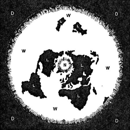
Samuel Birley Rowbotham's original map of the Flat Earth as presented in Earth Not a Globe, 1841
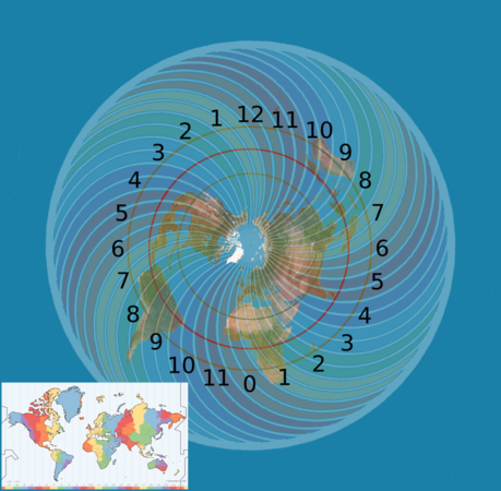
Monopole Timezone Map
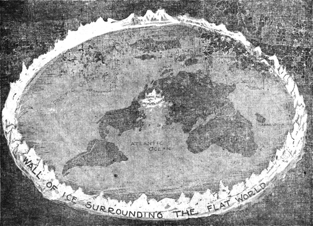
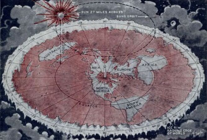
The Flat Earth as depicted in the New York journal, January 31st 1897
A Charles K. Johnson-era map produced by the Flat Earth Society, exact publication date unknown, circa 1980
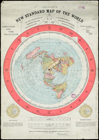
Alexander Gleason's New Standard Map of the World, November 1892
Wilbur Glenn Voliva's Flat Earth map, Modern Mechanics and Invention, October 1931
Samuel Rowbotham's Flat Earth Map of the World, circa 1873
A lecture poster from the Flat Earth Society's Samuel Shenton archive depicting his view of the Earth.
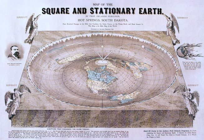
Prof. Orlando Ferguson's Map of the Square and Stationary Earth, 1893


.png)


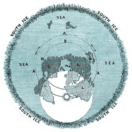
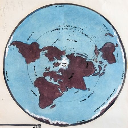
Bi-polar Models
The Bi-polar Model reflects the work of many Zeteticists who diverged from Rowbotham's work
Preferred variant of the Bi-polar map of Flat Earth proponent "sandokhan"


See Also
- The Bi-Polar Model