File:Gleason's Map.jpg
From The Flat Earth Wiki
Revision as of 15:46, 17 December 2019 by PeteSvarrior (talk | contribs)

Size of this preview: 423 × 599 pixels. Other resolutions: 169 × 240 pixels | 1,200 × 1,700 pixels.
Original file (1,200 × 1,700 pixels, file size: 1.66 MB, MIME type: image/jpeg)
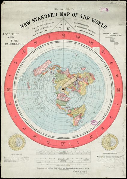
Gleason's New Standard Map of the World
on the projection of J. S. Christopher, Morden College, Blackheath, England; scientifically and practically correct; as "it is."
Published November 1892
Public Domain
File history
Click on a date/time to view the file as it appeared at that time.
| Date/Time | Thumbnail | Dimensions | User | Comment | |
|---|---|---|---|---|---|
| current | 13:55, 13 July 2018 |  | 1,200 × 1,700 (1.66 MB) | PeteSvarrior (talk | contribs) | Gleason's New Standard Map of the World on the projection of J. S. Christopher, Morden College, Blackheath, England; scientifically and practically correct; as "it is." Published November 1892 Public Domain |
You cannot overwrite this file.
File usage
The following page links to this file:
